Field Services

iWater infraMAP GIS Software

Their Challenge

A geographic information system (GIS) is a software system used to capture, store, display, and interact with data related to positions on Earth’s surface. The data is attached to a unique location stored in layers, allowing users to understand patterns and relationships between seemingly unrelated data. This data is crucial for the day-to-day operations of utility companies. For example, water-management firms need reliable GIS to map out pipes and determine where work must be done.

iWater provides water/wastewater/stormwater solutions with their own field crews. Driven by a desire to make their process more efficient, iWater created infraMAP software in 2002. The tool was originally designed for their own crews to reduce overtime, eliminate paperwork, and make everyone’s job easier. As the software grew in scale and complexity, they realized they needed a technical team to take over the maintenance and development of the system

Our Solution

Saritasa became iWater’s technology partner, taking ownership over the infraMAP software system to grow it into a SaaS solution for the gas, electric, public works, water, wastewater, and other utilities industries. The software is a GPS-guided mobile GIS solution for teams in the field to collect data and provide updates to a Utilities Asset Management program. It connects field crews, management, GIS, and Engineering into a highly customizable and scalable off-the-shelf product.

The systems offers an all-in-one task management tool for administrators while also providing tools for field workers. Clients include the City of , Golden State Water Company, City of Santa Ana, Las Vegas Valley Water District, City of Goleta, and more.

iWater infraMAP GIS Software

WhAt Benjamen Glover LLC Did:

GIS SaaS Product

Scalability is critical to the success of any SaaS product due to the large number of users on the platform at any given time. The infraMAP software is geared towards field crews, and the UI is easy to understand even for those with no prior GIS experience. The platform allows crews to draw on individual map layers to help identify issues and collaborate across teams. The system is hosted on Microsoft Azure for flexible scaling.
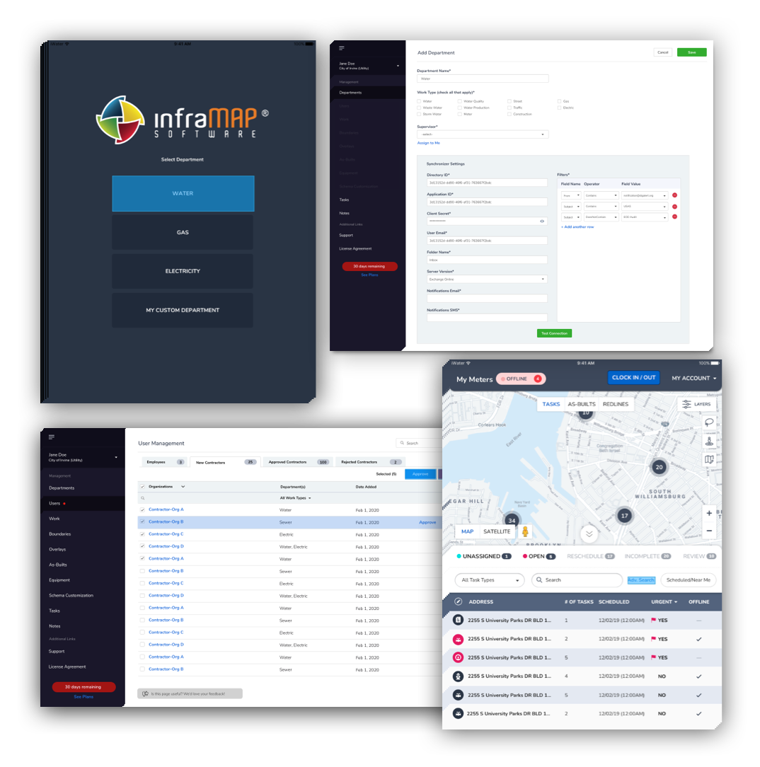
Multiple User Types

A wide variety of user types access the infraMAP platform, from company administrators and supervisors who create and assign tasks to contractors and crews who take and report on the tasks. Along with the different personnel, multiple industries use the system for unique purposes. Utility companies use it for pipe and cable maintenance. Electrical companies can mark emergencies, such as issues with electric cables. Food inspectors use the system to mark grease traps. Each industry has its own specific user cases, making the customization aspect of the platform critical.

Complex Workflows

Tasks for field teams are notoriously complex, with some requiring over 100 different data fields. Companies access an admin portal to customize the fields for individual tasks. Every part of the task is customizable, from the fields to the task types, to the icons. Every field is searchable. Tasks can be one-off, or repeating, like yearly pipe maintenance. The system generates reports for supervisors and administrators once tasks are completed.

Frontend & Backend Development

The frontend system is extremely complex due to the hundreds of customizable fields. The front end was built with Angular for tablet devices and desktops while the backend is .NET. Our front-end developers have extensive experience with making robust applications look and function well on web browsers. Easy, intuitive design was a critical component of this project, as all the tasks needed to be simple to access and fill in out in the field.

High-Precision GPS

The software integrates with a high-precision handheld GPS device that is pinpoint accurate. The GPS automatically move the map based on the user’s exact location, making it easy for teams to see where they are and identify issues. The system also provides turn-by-turn driving directions to any asset or address.

About Benjamen Glover LLC

Our CEO’s
message

1769

Successful Projects

5

Office Locations

10+

Years In Business

100

Fueled By Passion

Ready to start something great?